


Northern Antarctic Peninsula Map
Northern Antarctic Peninsula Map
Couldn't load pickup availability
British Antarctic Survey, 2017. Northern Antarctic Peninsula, 1:250 000 scale maps. BAS(UKAHT) Series, Sheets 3A and 3B, Edition 2. Cambridge, British Antarctic Survey.
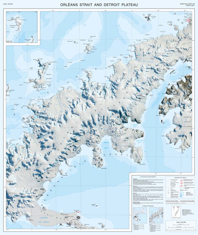
This double-sided map provides an overview of the northern part of the Antarctic Peninsula. It covers the area between Joinville Island and Hughes Bay, including James Ross and Snow Hill islands and the northern limit of the Larsen Ice Shelf on the east coast. It connects to map BAS(UKAHT) Sheet 2 to give full coverage of the northern Antarctic Peninsula as far south as Adelaide Island.
The two maps show topographic detail with a Landsat 8 satellite image mosaic backdrop. The maps include: Coastline; elevation information as contours and selected mountain summit heights; UK place names; scientific research stations; Historic Sites and Monuments (HSMs) and Antarctic Specially Protected Areas (ASPAs).
The map is printed on water-resistant paper and the folded version comes in a card cover.
Produced in collaboration with the UK Antarctic Heritage Trust.
- Cartography by the British Antarctic Survey
- Scale: 1:250,000 (Side A - Antarctic Sound and James Ross Island)
- Scale: 1:250,000 (Side B - Orleans Strait and Detroit Plateau)
- Page size 750 x 890 mm (width x height)
Shipping & Delivery
Shipping & Delivery
United Kingdom
- Free delivery on orders over £80
- Orders under £80: £5.99
- 2-4 business days
EU (European Union)
- £7.99-29.99
- 2-11 business days
- Calculated at checkout based on weight
- You may be asked to pay local VAT and duties before being able to claim your parcel.
International
- £12.99-39.99
- 3-17 business days
- Calculated at checkout based on weight
- You may be asked to pay local VAT and duties before being able to claim your parcel.
See our Shipping Policy for more information