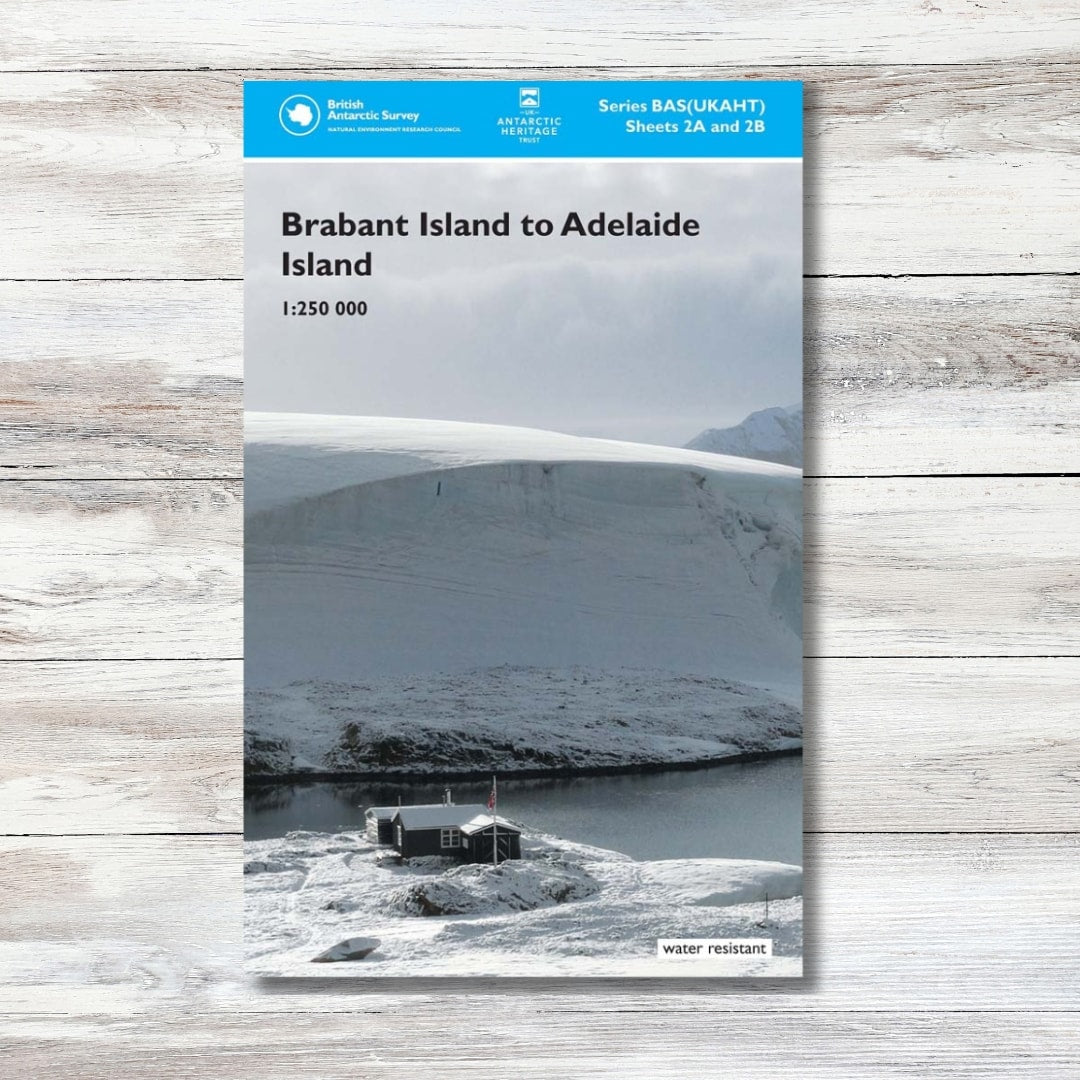


Brabant Island to Adelaide Island Map
Brabant Island to Adelaide Island Map
Couldn't load pickup availability
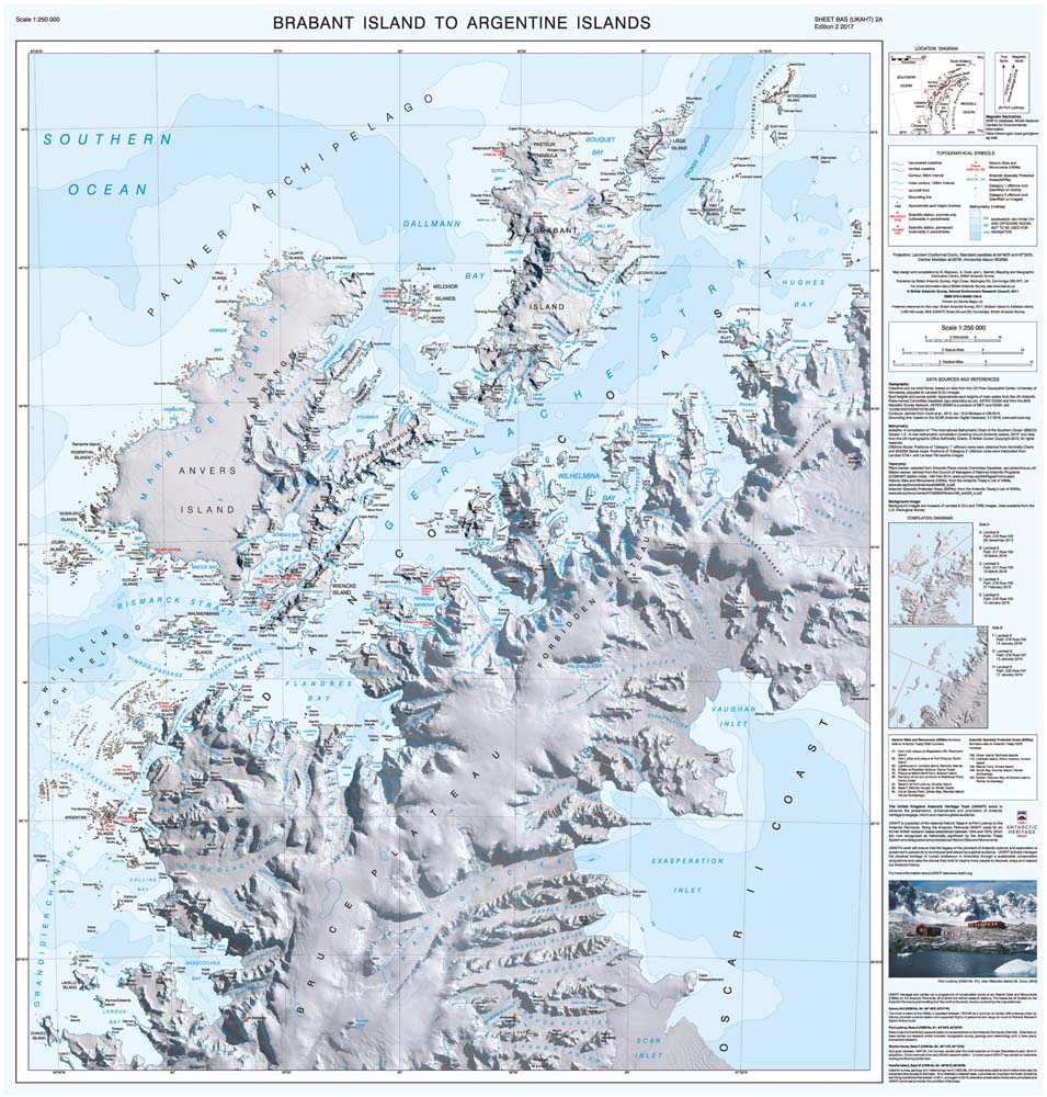
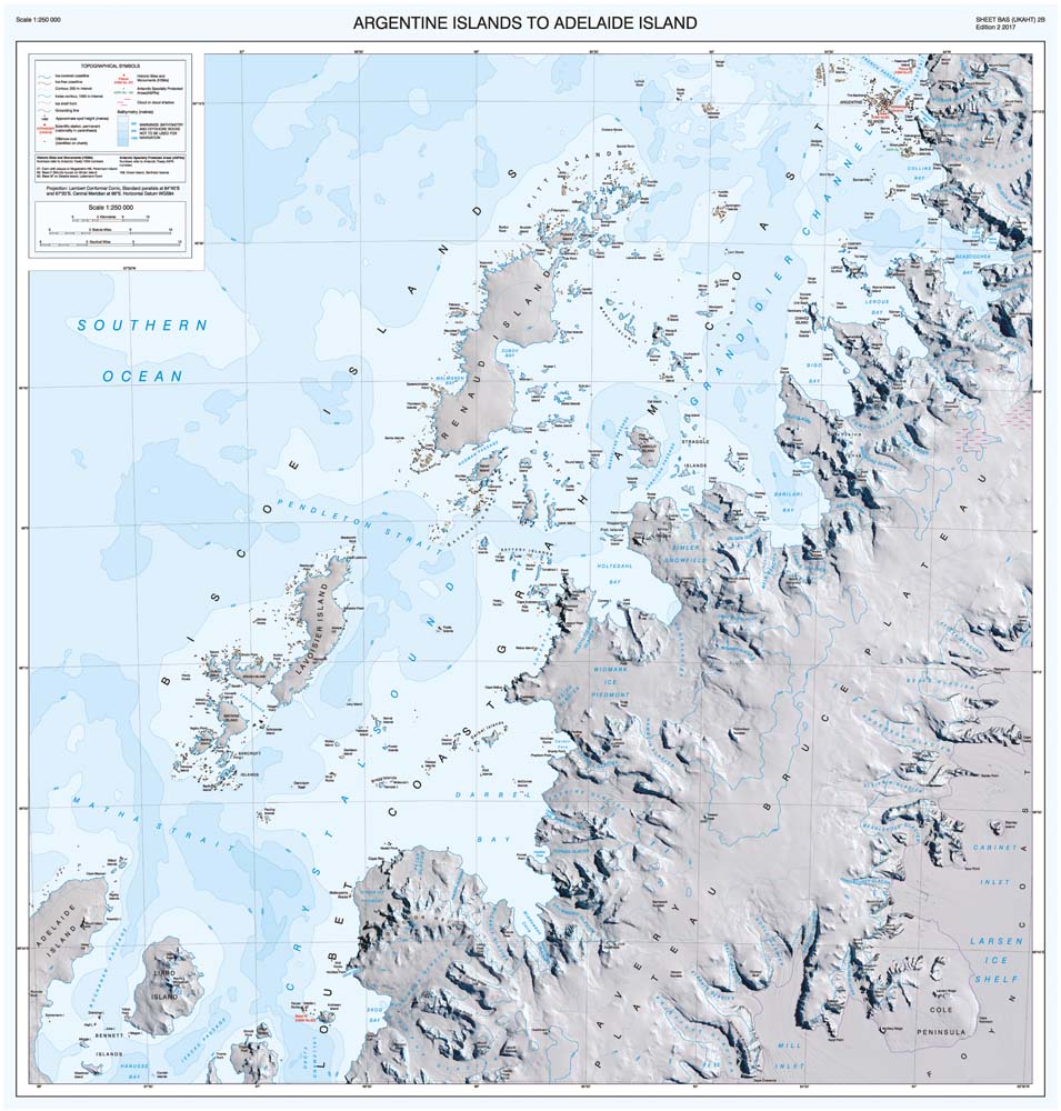
This folded map covers the west coast of the Antarctic Peninsula between Brabant Island and the Adelaide Islands, including: Gerlache Strait, Lemaire Channel, Palmer Station, Vernadsky Station, Grandidier Channel, Crystal Sound and Port Lockroy Historic Site. It also covers part of the east coast including Exasperation Inlet and Crane Glacier. It connects to map BAS/UKAHT 3 to give full coverage of the northern Antarctic Peninsula north of the Adelaide Islands.
The map shows topographic detail with a Landsat 8 satellite image mosaic backdrop. It includes coastline; elevation information as contours and selected mountain summit heights; UK place-names; scientific research stations; Historic Sites and Monuments (HSMs) and Antarctic Specially Protected Areas (ASPAs).
- Scale: 1:250,000
- Cartography by the British Antarctic Survey
- Sheet 2A & 2B
Shipping & Delivery
Shipping & Delivery
United Kingdom
- Free delivery on orders over £80
- Orders under £80: £5.99
- 2-4 business days
EU (European Union)
- £7.99-29.99
- 2-11 business days
- Calculated at checkout based on weight
- You may be asked to pay local VAT and duties before being able to claim your parcel.
International
- £12.99-39.99
- 3-17 business days
- Calculated at checkout based on weight
- You may be asked to pay local VAT and duties before being able to claim your parcel.
See our Shipping Policy for more information